EVENTS
گزارش پنج ساله پژوهشکده محیط زیست دانشگاه تبریز 1395-1400
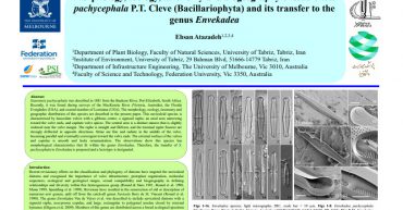
Morphology, ecology, taxonomy and biogeography of Stauroneis pachycephala P.T. Cleve (Bacillariophyta) and its transfer to the genus Envekadea Download
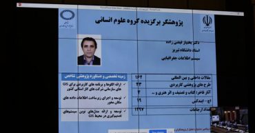
در بیست و یکمین جشنواره تجلیل از پژوهشگران و فناوران برگزیده کشور سال ۹۹، عضو هیات علمی دانشگاه تبریز به عنوان پژوهشگر برتر کشور انتخاب شد. به گزارش روابط عمومی دانشگاه تبریز، دکتر بختیار فیضی زاده عضو هیات علمی گروه سنجش از دور و سیستم اطلاعات جغرافیایی GIS دانشکده برنامه ریزی و علوم محیطی دانشگاه تبریز، در […]
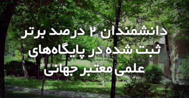
نام دكتر بهنام محمدي، دكتر رقيه حاجي بلند، دكتر مهران صباحي، دکتر مهدی ضرغامي، دکتر وحید نوراني،دکتر بختیار فيضي زاده و دکتر علیرضا ختايي در فهرست دانشمندان ۲ درصد برتر جهان براساس دادههای پایگاه اسکوپوس درسال 2019 قرار گرفتند
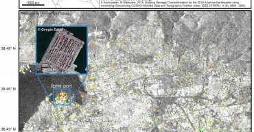
After the M7 earthquake near Samos island, InSAR change map of Izmir is produced from a set of Sentinel-1 images (24 days) over the built-up areas. Forward changes can be interpreted as possible earthquake damage if other anthropogenic activities (reverse changes) do not exist. In the disaster-stricken area some anthropogenic activities can be detected if […]

On the 4th August 2020 two severe explosions occurred in Beirut. We have used three synthetic aperture radar (SAR) images with VV polarization to apply InSAR coherence detection method to identify the damaged/collapsed buildings.

Synthetic aperture radar (SAR) damage map for Beirut (Lebanon) explosion is created from co-polarization descending Sentinel-1 data (VV) between 2020.07.24 and 2020.08.05. The affected areas are detected from a relative change of backscattering coefficient and RGB color composition. The urban areas are extracted from the global urban footprint (GUF). Red areas are possibly damaged areas, […]

موفقیت محققان پژوهشکده محیط زیست دانشگاه در مطالعه و مدلسازی شبکه آب شرب دانشگاه تبریز برای کاهش هدر رفت و حوادث آن دانلود گزارش

Preliminary flood mapping in Kyushu island using ascending-descedning ALOS-2 PALSAR-2 images